MLFF Overview Film
A 60-second film showing the problem, gantry detection, sensor fusion, and command-center settlement.
MLFF removes booths and barriers. RITAIS adds the missing engineering depth: multi-sensor fusion, edge processing, OFC backhaul, AI operations and clearing integration.
This page is the MLFF overview. Detailed pages own the deep technical material: LiDAR, 4D radar, sensor fusion, transactions, enforcement, field cabinets and use cases.
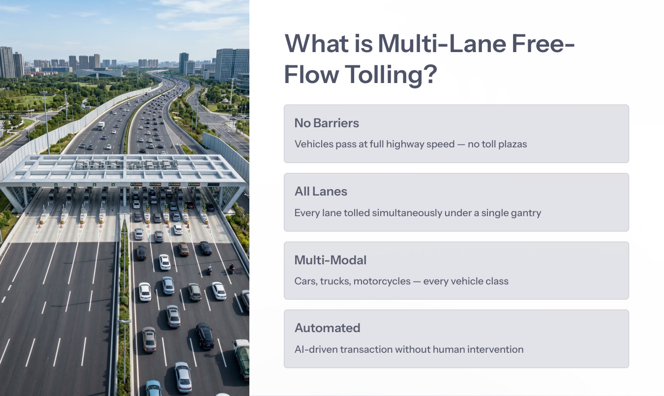
Vehicles pass at full highway speed without toll plazas.
Every lane is tolled simultaneously under a gantry.
Cars, trucks, motorcycles and commercial vehicles are handled.
AI-driven transaction generation with reduced human intervention.
A 60-second film showing the problem, gantry detection, sensor fusion, and command-center settlement.
A 60-second film showing the problem, gantry detection, sensor fusion, and command-center settlement.
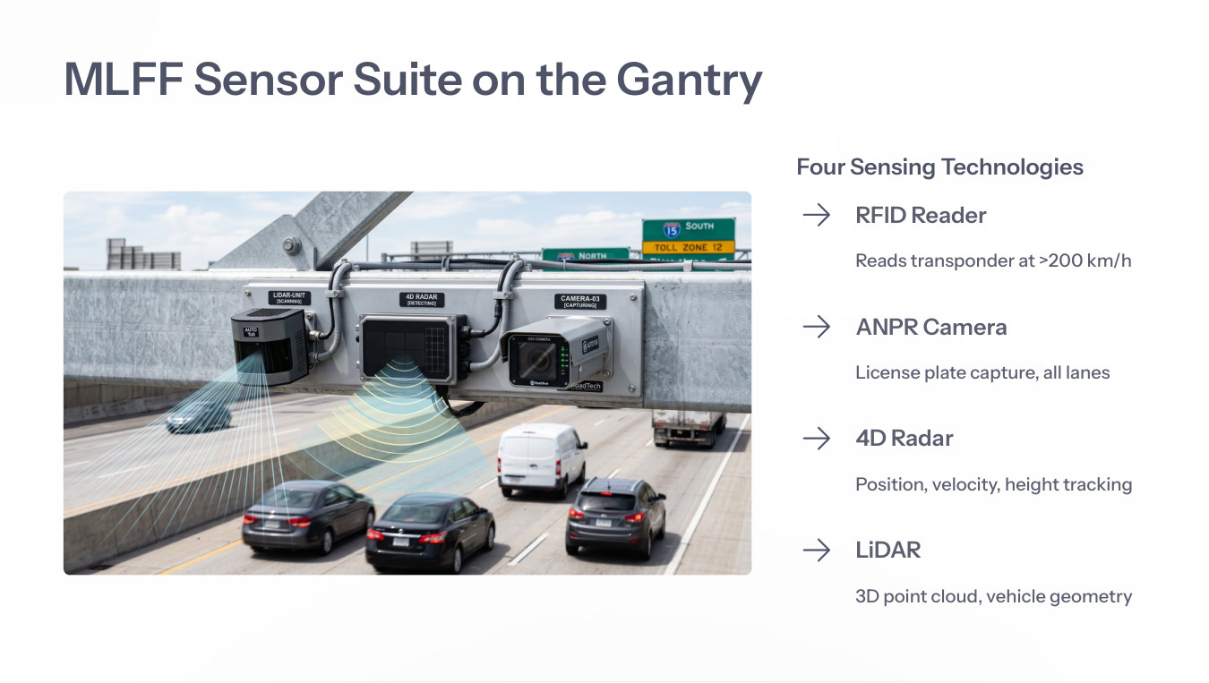
RFID reads account identity, ANPR captures the plate, 4D radar tracks motion and LiDAR generates 3D geometry. The fusion engine converts these inputs into one legally defensible vehicle record.
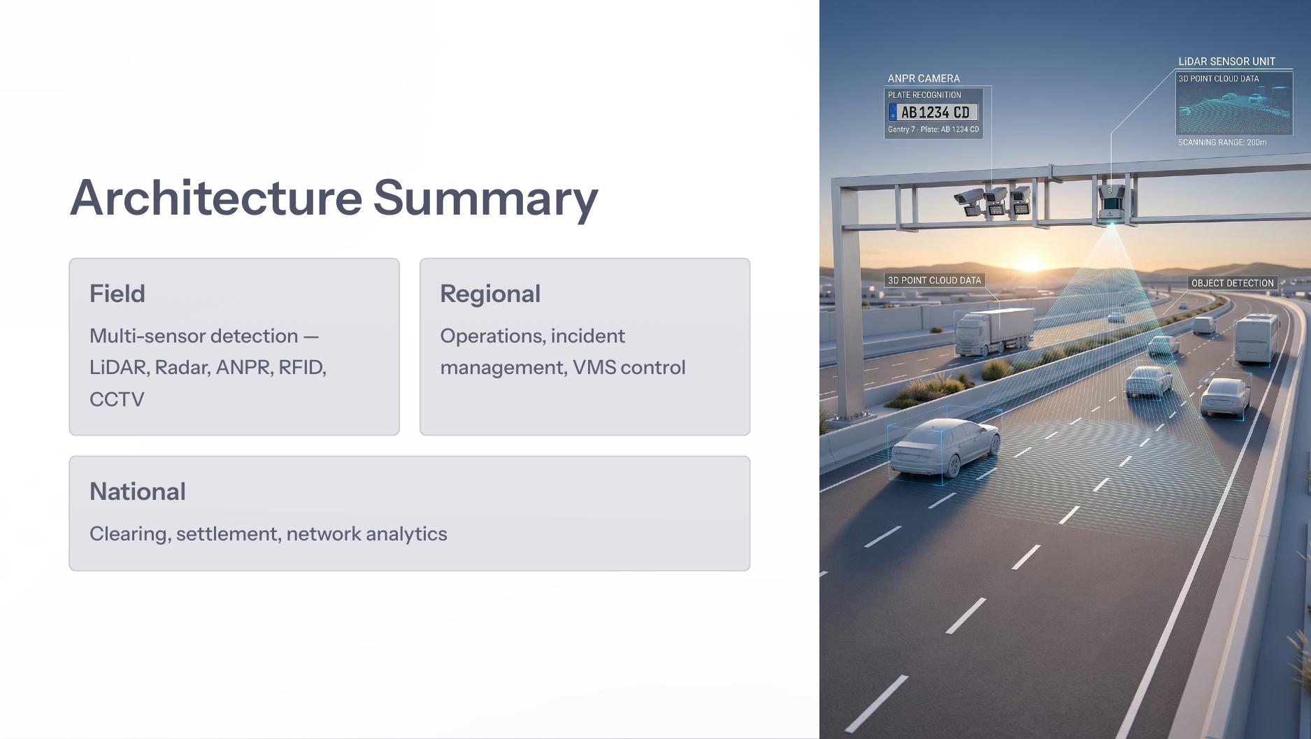
RITAIS connects field devices to regional operations and national clearing so every vehicle event can become an auditable transaction, operational alert or analytics signal.
3D point cloud, height mapping, axle estimation and vehicle separation.
Open →Range, azimuth, elevation and Doppler velocity for persistent tracking.
Open →Sensor record assembly, toll calculation, account debit and clearing.
Open →High-speed flow, lane changes, truck occlusion and enforcement.
Open →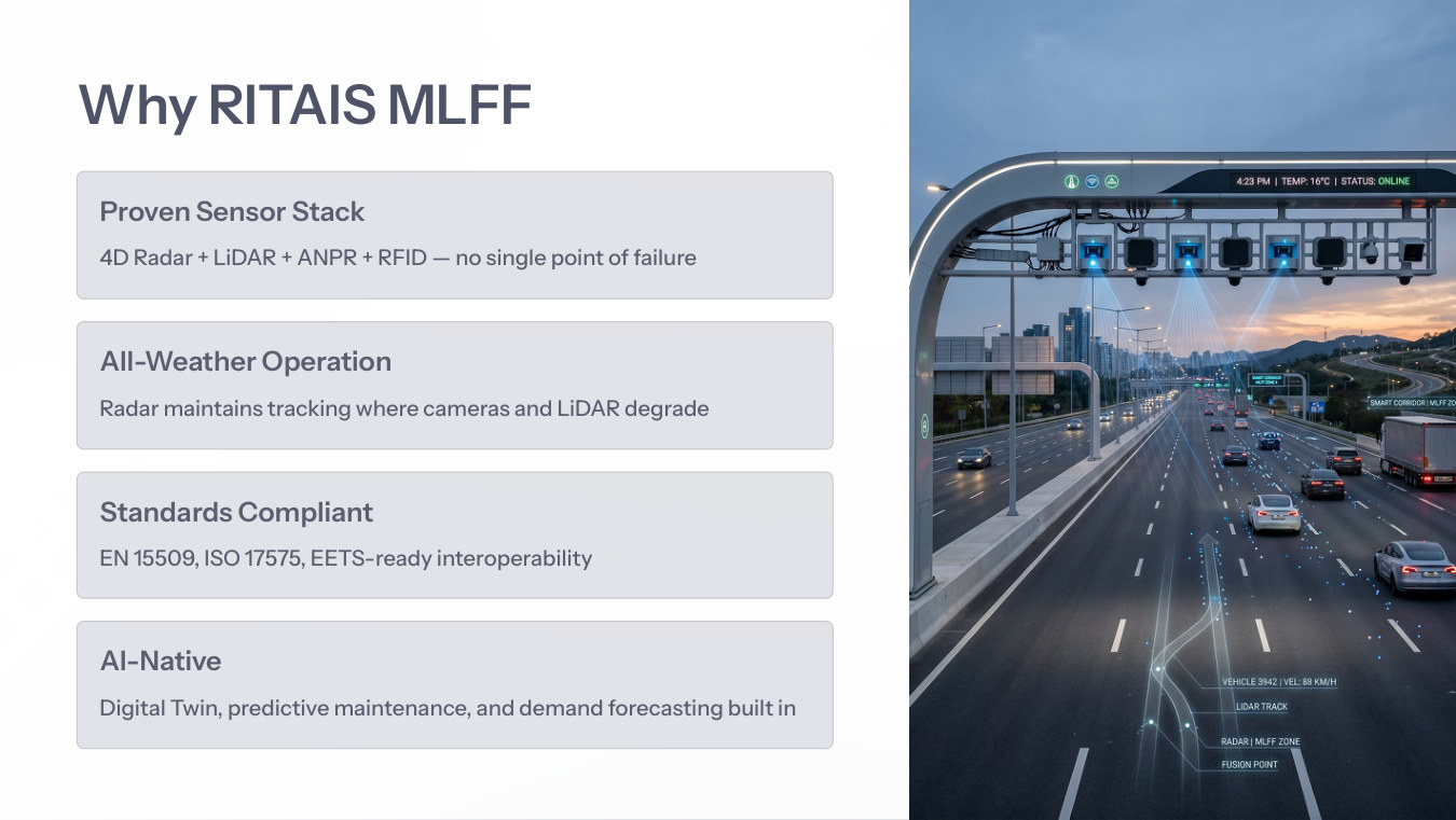
The MLFF architecture is designed around four ideas: no single point of sensor failure, radar fallback in adverse weather, standards-compliant interoperability, and AI-native digital-twin operations.