AI Transportation Platform
Planned runtime: 60 seconds.
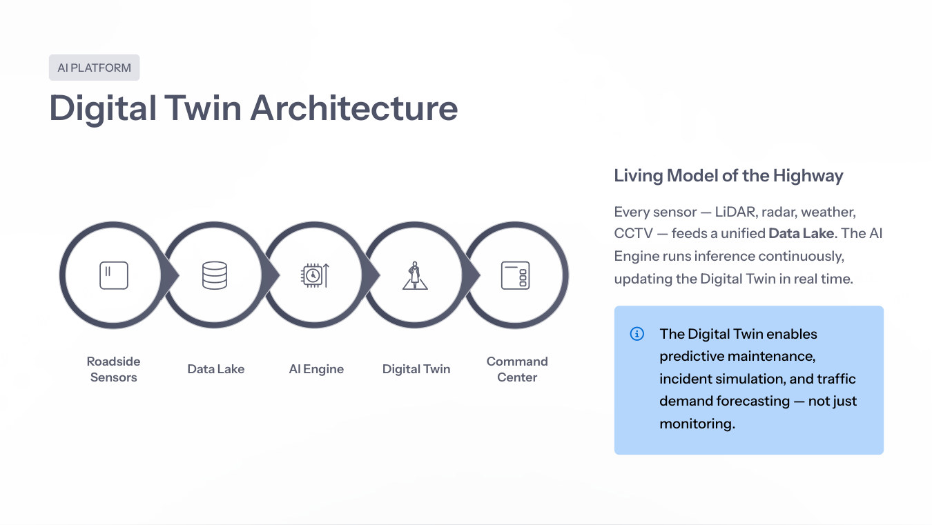
RITAIS converts LiDAR, radar, weather, CCTV and tolling events into a living digital twin for operations, maintenance and planning.
Every sensor feed becomes a live input to the AI engine, creating a real-time replica of the highway for predictive operations.
Digital Twin PageThe AI platform film explains the operational data pipeline; the digital-twin film demonstrates simulation, prediction and decision support.
Planned runtime: 60 seconds.
Planned runtime: 60–90 seconds.
Wrong-way drivers, stopped vehicles and debris detected in real time from fused data.
Sensor health scoring flags degraded LiDAR or radar before failure.
ML models predict congestion 30-60 minutes ahead.
Cross-gantry re-identification for OD analytics and planning.
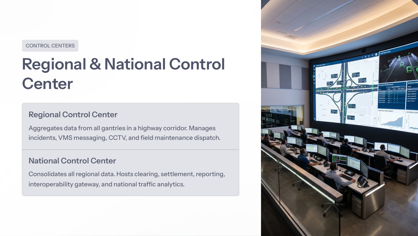
Regional centers manage gantries, incidents, VMS and field dispatch. National centers consolidate clearing, settlement, reporting, interoperability and traffic analytics.
Architecture Library