Integrated MLFF tolling, roadside sensing, resilient OFC networks, command centers and AI platforms—engineered as one production-ready transport ecosystem.
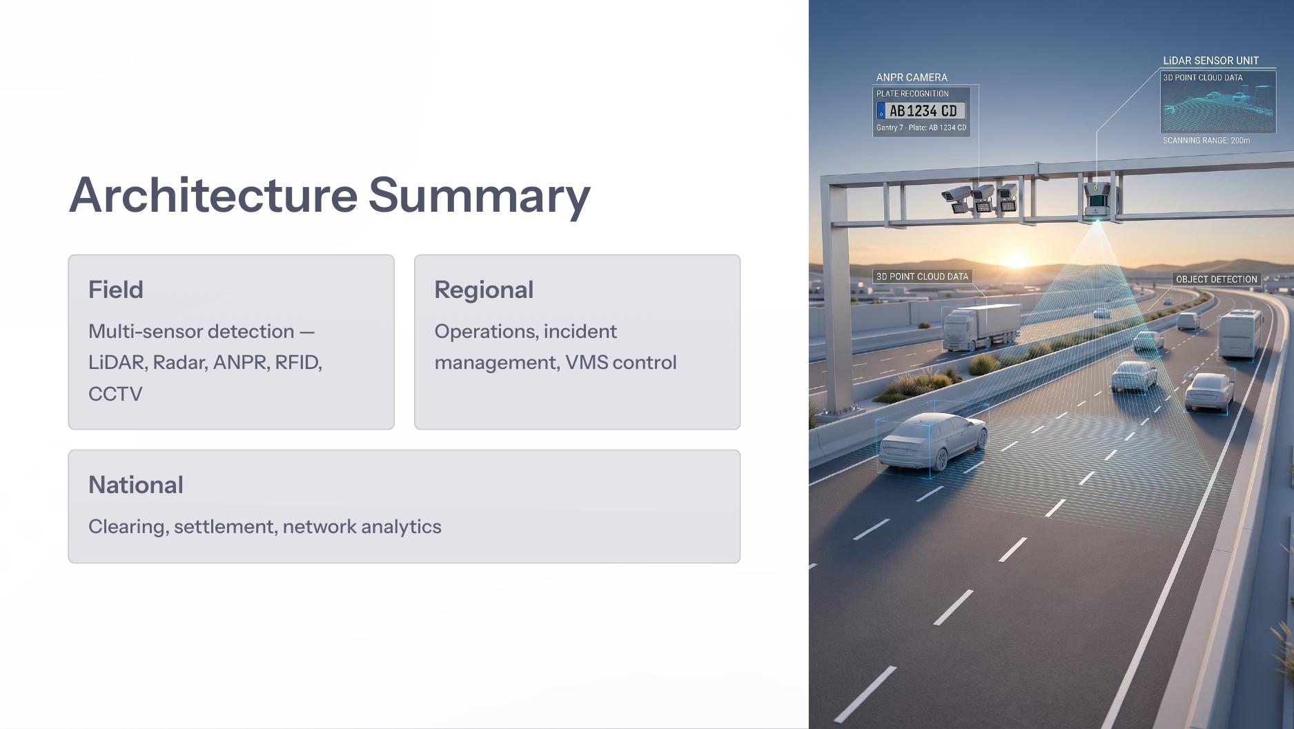
LiDAR, 4D radar, ANPR, RFID and CCTV capture vehicle presence, identity, speed and evidence.
Redundant fiber rings connect gantries, field cabinets, RSUs and control centers.
Operators manage corridor status, incidents, CCTV, VMS and field maintenance.
Sensor streams feed data lakes, digital twins, forecasting and performance analytics.
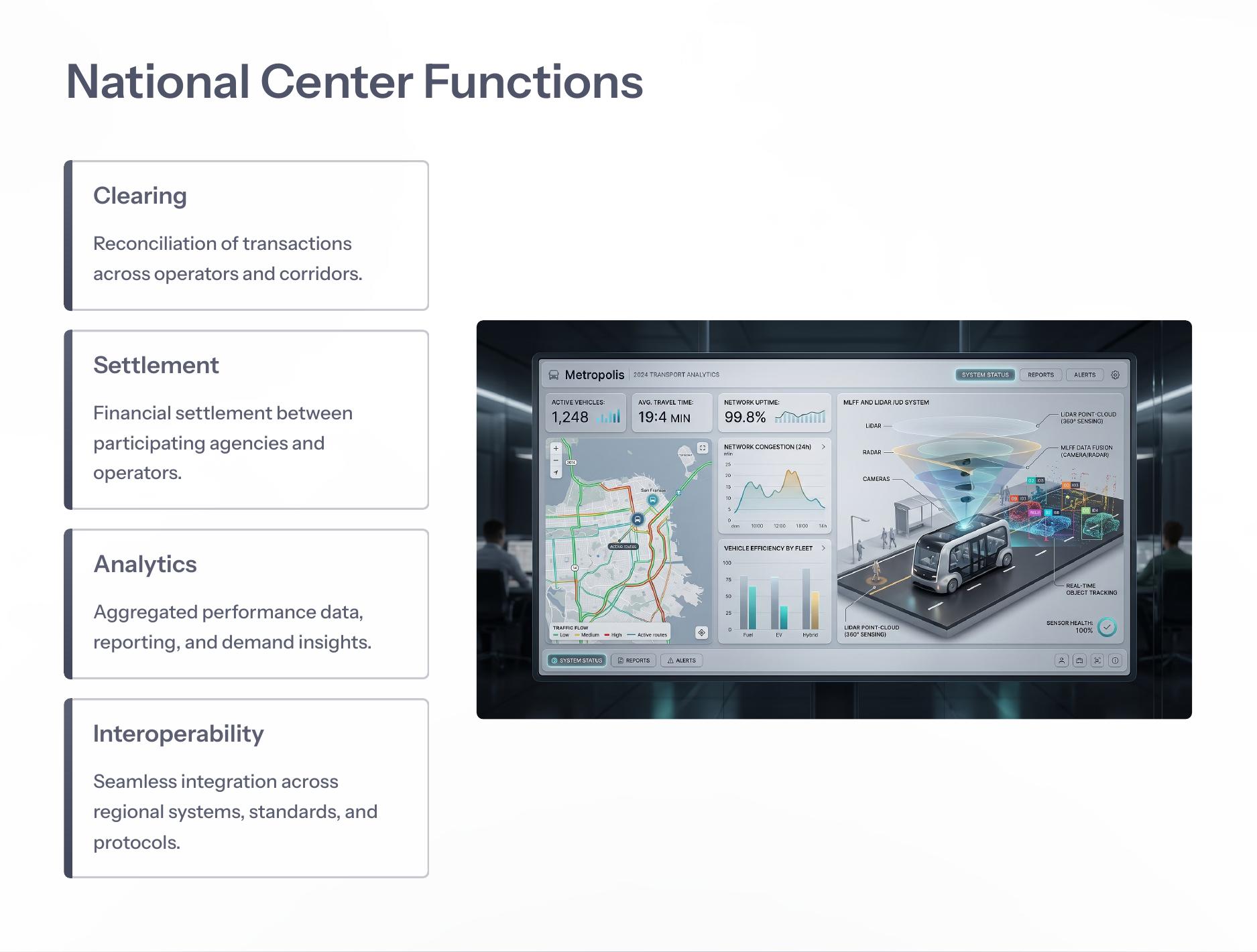
Transactions are reconciled, settled, reported and routed across schemes and operators.
A common architecture connects roadside sensing, resilient communications, corridor operations, AI intelligence and financial settlement. Explore each layer for focused technical detail.
RITAIS integrates sensors, communications, command centers and AI into production-grade systems designed for reliability, traceability and scale.
Zero-stop tolling using RFID, ANPR, LiDAR, 4D radar and sensor fusion.
Open →3D point clouds for geometry, height, vehicle separation and class confirmation.
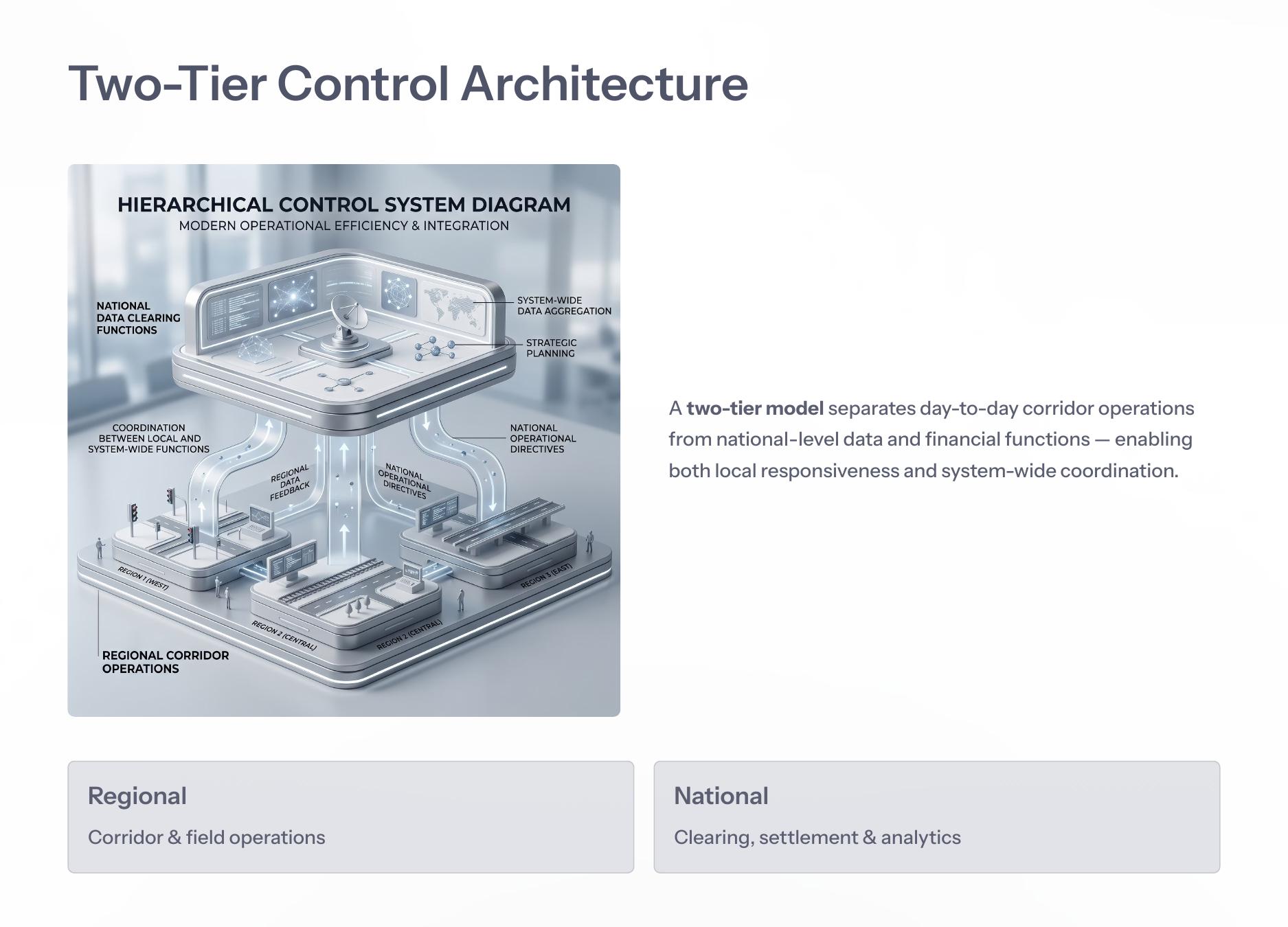
Open →Regional corridor operations and national clearing, settlement and analytics.
Open →Self-healing optical fiber rings connecting roadside and control-center systems.
Open →Regional centers manage lane status, transaction processing, incident response and VMS messaging. National centers consolidate clearing, settlement, reporting and interoperability.
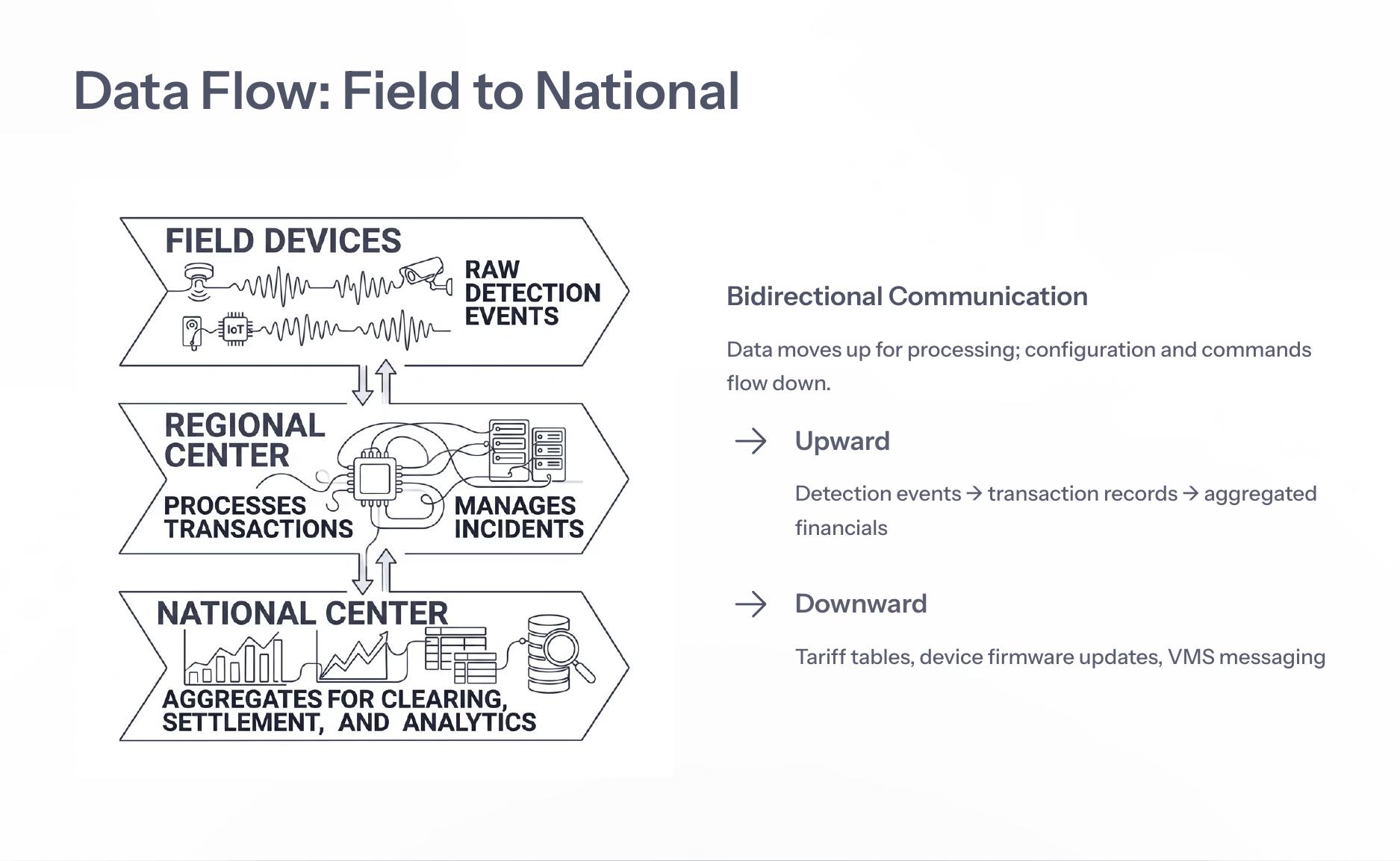
Detection events, transactions and aggregated financials flow upward. Tariff tables, firmware updates and VMS messaging flow downward to roadside systems.
View Data FlowExplore consolidated architecture diagrams, use cases and whitepapers for MLFF, command centers, sensor fusion, OFC, AI and settlement workflows.